
Algonquin Park Trails
Take pictures, leave footprints
Check out these interpretive trails accessible from the Highway 60 corridor in Algonquin Park. There are trails for everyone from hikers to bikers to strollers, wheelchairs or mobility device users!
Algonquin Park Trail List
Check out these interpretive trails accessible from the Highway 60 corridor in Algonquin Park. Trails marked "Easy" are device (strollers or wheelchairs) accessible. Trails suitable for biking are labeled accordingly. You need a Park Permit to access all trails in Algonquin Park.
Easy (Wheelchair accessible)
(km54.5) Algonquin Museum (1.3km loop)
(km42.5) Spruce Bog Boardwalk (1.5km loop)
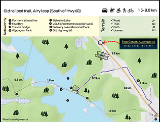
Old Railway Bike Trail (Max 32km)
(see Old Railway Bike Trail map)
Moderate
(km45.2) Beaver Pond (2km loop)
(km31) Two Rivers Trail (2.3km loop)
(km27.2) Hemlock Bluff (3.5km loop)
(km19.2) Peck Lake (2.3km loop)
(km15.4) Mizzy Lake (10.8km loop)
(km10.8) Hardwood lookout (1km loop)
(km7.2) Whiskey Rapids (2.1km loop)
(km23.0) Minnesing Bike Trail (4.7-32.2km)
Difficult
(km40.3) Booth's Rock (5.1km loop)
(km39.7) Lookout Trail (2.1km loop)
(km37.6) Centennial Ridges (10.4km loop)
Borrow our all-terrain wheelchair
Borrow our Hippocampe all-terrain accessible wheelchair for use on the "easy" and "local" trails.
For more information, visit our Quartermaster Shack.
(Pro tip: You can borrow a wheelchair for free even if you're not staying with us.) Thank you to the Federal Enabling Accessibility Fund for making this gift possible.
Local Algonquin Trails & Routes
Classified as "easy", these trails and routes between Four Corners and the village of Whitney are all wheelchair accessible and suitable for walking or biking. Some use public and private spaces, so remember to be courteous, watch for vehicles and share the road. Please don't litter or touch private property. A park permit is not required for these routes.


.png)
